Higher House Farm was a substantial upland holding, complete with barn, stables, and shippons (cow barns). It stood on the moors above Anglezarke, with ruins visible on both sides of the road. The name reflects its position above Lower House, which lay further down the slope.
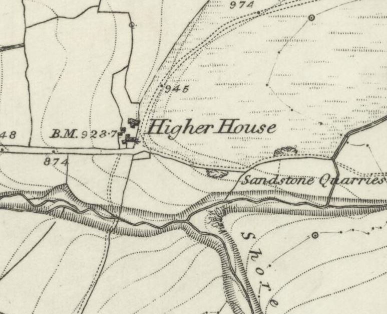
The farm track from Higher House led to a shallow quarry known as the Flag Delph, where large slabs of sandstone were quarried. This stone “would split easily and evenly, thus making ideal material for floors and walls.” The track continued past the quarry to the ruins of a farm called the Comp, the only farm on Rivington Moor. Locally, the name was said to be a corruption of “camp,” with traditions claiming either Roman soldiers or Cromwell’s men had encamped there.
Families & Residents
John Rawlinson, author of the classic About Rivington, recorded oral testimony about life at Higher House. He asked an old Rivingtonian how farmers transported coal and other materials before the motor age. The reply was:
“They had light two wheeled carts, with large diameter wheels, about 3 ft. 6 inches, pulled by one horse and they only carried from five to six hundred‑weight at one loading. He was assured that with a Horse reared in the district they could go wherever needed.”
This account captures the practical ingenuity of the farmers who lived here.
Farming & Daily Life
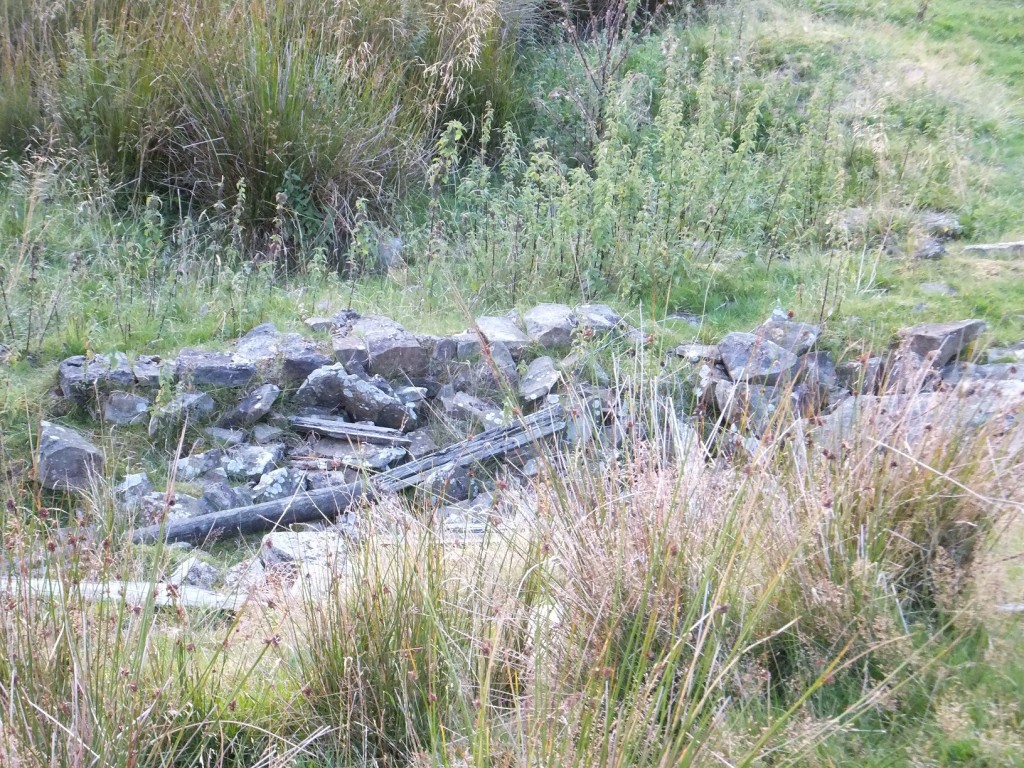
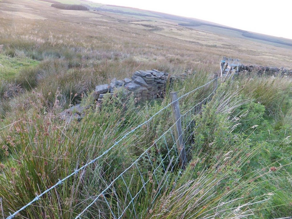
Across the lane from the ruins lay a cattle pound and sheep pen. A footpath led south over a ford in the brook, across the slope of the hill, with a sheepfold about halfway, to Lower House. Farmers also worked two coal outcrop pits in the steep bank of the brook near the ford. These were filled in long ago, but they once provided fuel for villagers and farm families.
The quarry at Flag Delph supplied sandstone for building, while the farm itself supported cattle and sheep. The ruins show evidence of extensive activity on both sides of the road.
Architecture & Features
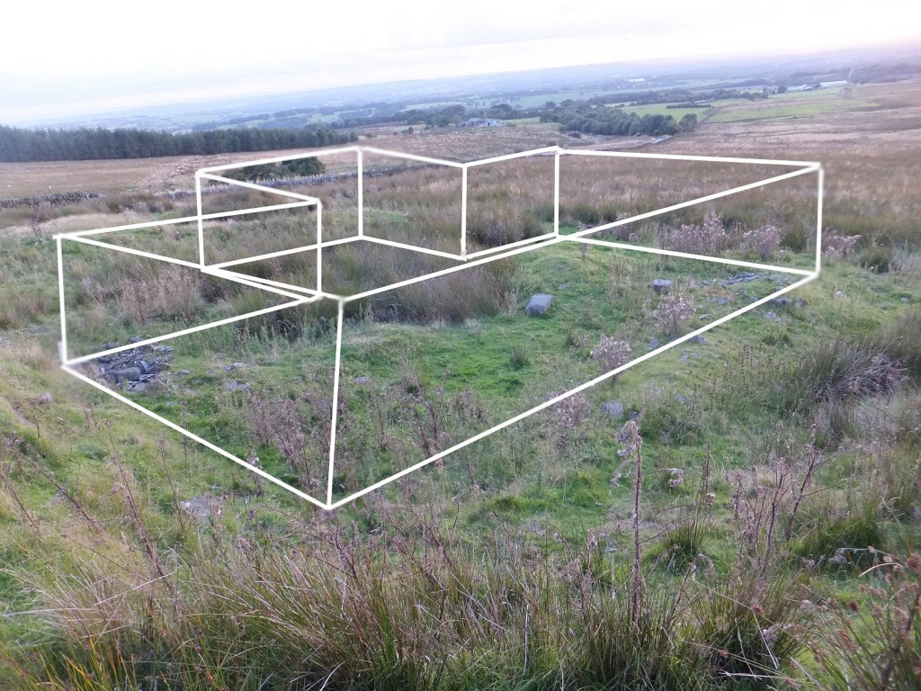
Higher House was a large setup, with multiple outbuildings. The ruins come close to the fenceline by the road, and “clear stone remains possibly of a corner piece” are still visible. A layout drawn in 2014 shows the outline of the largest structure. Despite heavy sheep activity, “there is still quite a lot of stone present.”
Tradition holds that Viscount Leverhulme was shown the signalling station at Winter Hill and had the site excavated. “Some relics were found and after his death they were deposited in Liverpool Museum.” Later visitors attempted to trace these finds, but “to no avail.”
Decline & Ruin
During the late war and for some years afterwards, the army authorities laid an explosives store near the corner of the lane. Parties of soldiers with tanks came to the district for training, “using the derelict buildings of the old farms as targets for the guns mounted on the tanks.” This military use accelerated the ruin of Higher House.
By the twentieth century, the farm no longer appeared on maps, though its ruins remained visible.
Present Day
Higher House does not feature on current maps, but “there are bits to see even now.” The ruins lie close to the road, with stone outlines still traceable. The site offers views towards the Pigeon Tower, though it is out of sight. Today, Higher House stands as one of the more substantial ruin sites of Anglezarke, its story preserved in oral testimony, quarry remains, and the scattered stones of its farmstead.