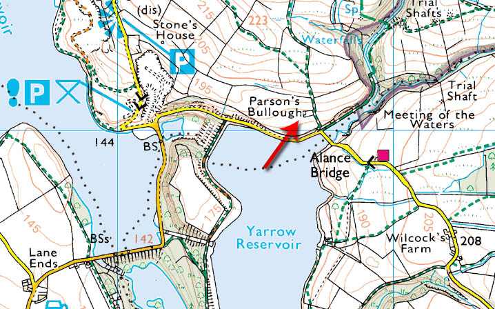
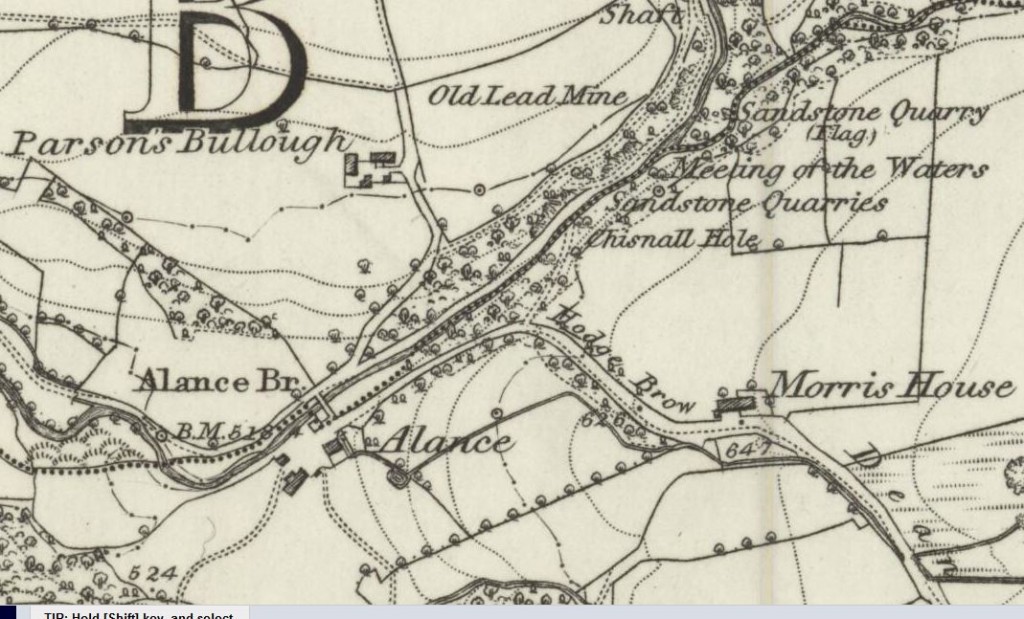
Parson’s Bullough lies near Lead Mines Clough, on the track that once led to the abandoned hamlet of Alance, now beneath the waters of Yarrow Reservoir. The name was taken from “Bula,” a surname, and “haugh,” meaning “flat land near a river.”
Many of the farmers around here were Flemish, having fled from the 1572 massacre of St. Bartholomew’s Day.
They were renowned for their toughness, “prepared to earn a living in places where others refused.” It is reckoned that they also “brought handloom weaving to these moors.”
Families & Residents
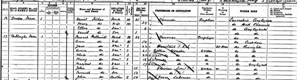
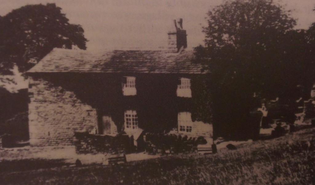
Census records reveal that in the 1800s there were 70 acres of land associated with farmer John Halliwell. With his wife Jane, they had seven children here — Betty, Ann, Samuel, Ann, Jane jr., Margaret, and John jr. The farm was passed down to one of the sons, Samuel.
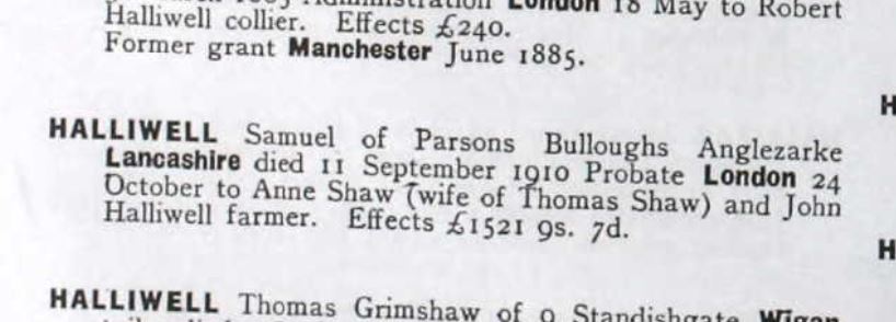
What follows is a grim story. Samuel became a widower, and in September 1910 he committed suicide at the farm. He was 71 years old, suffering from asthma and insomnia. His sons, Samuel Jr. and John, “saw a shaving mirror on a wall in the farmyard, and they found their father bleeding to death with his throat cut. A razor was on a trestle nearby.”
This account is preserved in the England & Wales National Probate Calendar (Index of Wills and Administrations), 1858–1966.
Farming & Daily Life
The Halliwell family farmed 70 acres here, combining sheep‑rearing with weaving. The Flemish settlers’ industriousness was remembered in local tradition, and the Halliwells continued that legacy.
Architecture & Features
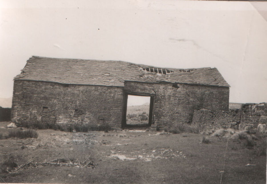
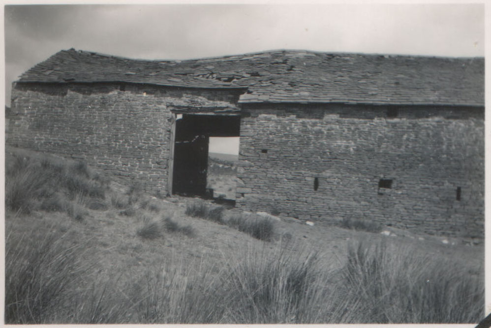
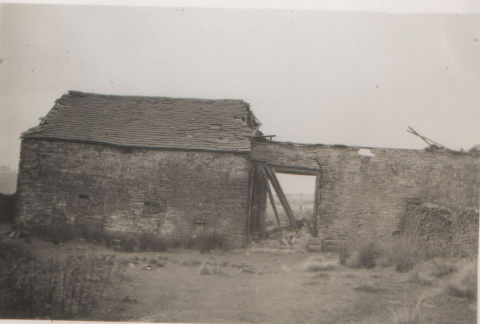
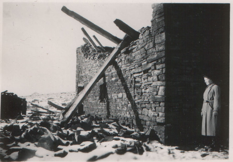
Photographs show the barn before and after the great gale of 1957. “In 1957, there was a huge gale, and the roof of this barn was terribly damaged.” A further storm later “took the roof clean off.”
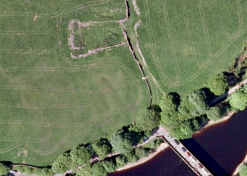
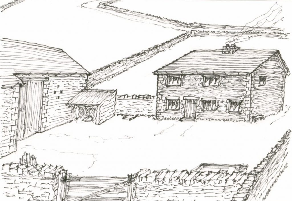
David Owen’s sketch matches the Google Earth aerial view, placing the house on the north face of the square. Aerial photography today makes for an interesting comparison with old mapping.
The old track to the ruin is still present, now a farmer’s track accessed by a five‑barred gate near the new Alance Bridge.
Decline & Ruin
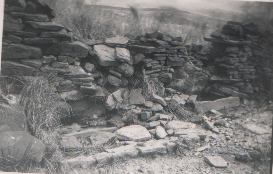
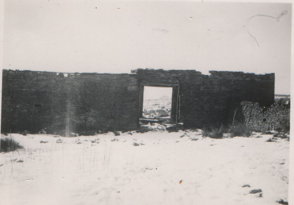
It was reported in the 1930s that the house was demolished, though “the barn was said to be still in a good state of preservation and in use.” The barn has since gone to ruin, though “there is an old stone hut which could be original.”
The farm fell into disrepair along with other dwellings of the moors when Liverpool Corporation took ownership of the whole area.
Present Day
Today, Parson’s Bullough is a ruin, though farming continues nearby. Sheep share their space with curlew and lapwings.
The outlines of the farmhouse and barn remain visible, and the gory tale of Samuel Halliwell lingers as one of the most haunting stories of Anglezarke.