Anderton’s was one of three farms affected by the creation of Yarrow Reservoir.
Unlike the others, it escaped complete destruction, with ground evidence still visible today.
The farm is believed to have existed as far back as 1610, when the Rivington Muniments record James and Jennet Anderton living on Anglezarke Moor.
At that time they were both around forty years of age, and the survey notes “30 sheep present at the dwelling, and 6 days of the year taken up by shearing.” Six hens were also recorded, and a yearly rent was paid of “£0 15s 8d.”
Families & Residents
The Anderton family remained tied to the farm for centuries. The 1610 record of James and Jennet is the earliest known, but later generations continued to occupy the site.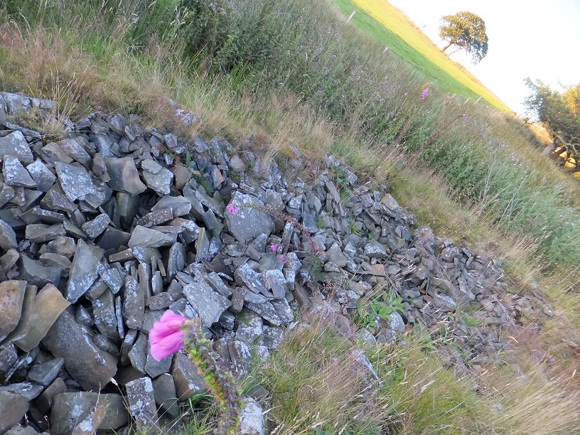
A particularly vivid episode occurred in 1837, when Thomas Anderton, the farmer’s son aged twenty‑eight, disappeared from the property. The Bolton Free Press reported on 11 March that the inhabitants of Anglezarke were…
“…in a state of anxiety for a number of days due to the sudden disappearance of Thomas Anderton, the farmer’s son.” He was described as “labouring under an aberration of the mind from the effects of a brain fever.” On 9 February he had escaped from home and “no tidings might be learned as to where he had gone.” No‑one had seen him and “numerous and vain were their conjectures.”
The family searched every brook, ditch, and pond in the neighbourhood without success. Eventually, Mrs. Parr, who lived in a nearby dwelling rented from Mr. Anderton, reported strange noises in her hay‑loft. When Mr. Anderton investigated, he found his son hidden in one corner, having been absent almost twenty days. The newspaper described his condition: “a truly pitiable appearance, being reduced to a perfect skeleton in human form, and his skin appeared to be in an almost putrid state, being marked with livid spots of an almost purple hue.”
Thomas explained that after leaving home he had hidden in a bush for a day and night, then moved into the hay‑loft where he remained until discovered. He had eaten nothing except “a little hay which appeared to be nibbled where he lay as if the rats had been amongst it.” Though a surgeon was called, “nature had become too much exhausted and he died on Wednesday 8th March.”
Farming & Daily Life
Anderton’s was a substantial farm, with sheep, hens, and pasture recorded in early surveys. The family also rented out land nearby, with tenants such as Mr. Parr occupying dwellings close to the farm. Its position on the edge of the reservoir meant that farming continued here longer than at neighbouring sites, though the land was eventually absorbed into the catchment area.
Architecture & Features
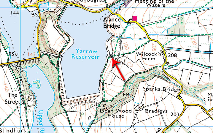
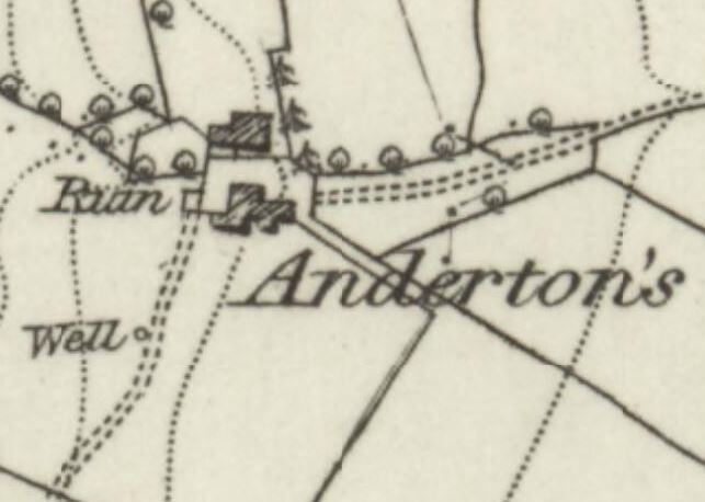
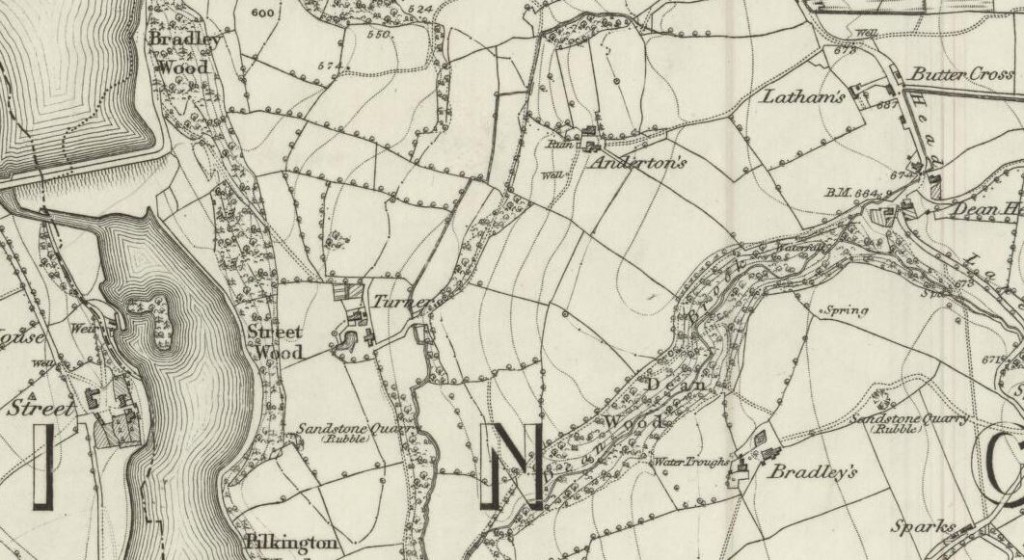
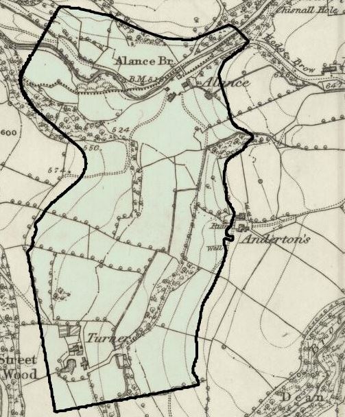
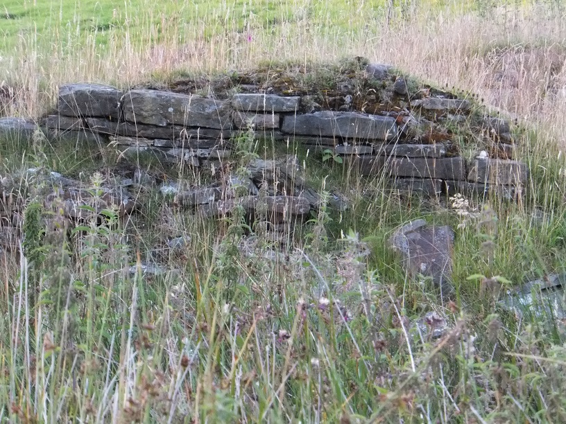
Old maps show Anderton’s clearly. On the 1849 Ordnance Survey, the farm appears centre‑right, with the later border of Yarrow Reservoir added for comparison. Ruinous structures surround the intact farmstead, suggesting earlier buildings or outbuildings.
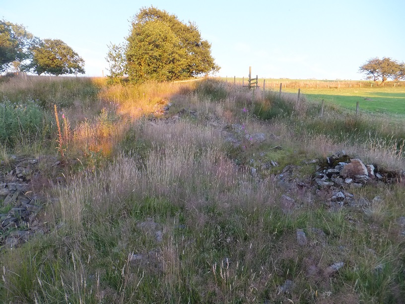
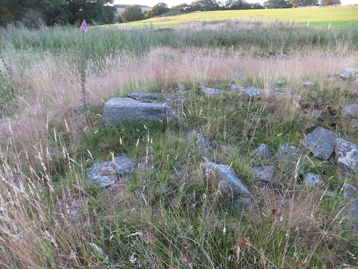
Photographs taken when the reservoir was low reveal walls, foundations, and sections of stonework still standing. The most intact part of the ruins lies on the south‑eastern side of the site, though thick summer growth often obscures the evidence.
Decline & Ruin
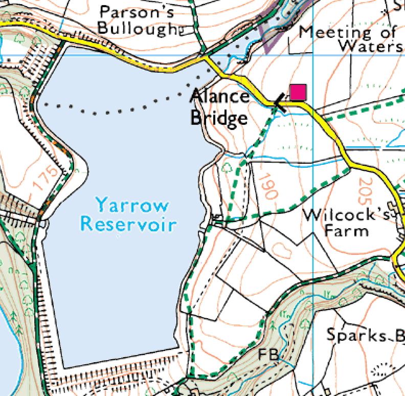
The construction of Yarrow Reservoir in the mid‑nineteenth century marked the beginning of decline. While some farms were lost forever, Anderton’s survived “by a whisker,” its grounds lying just outside the reservoir shore. Over time, however, the farm was abandoned, and by the twentieth century only ruins remained.
Present Day
Today, Anderton’s is still traceable on the ground. Sections of wall, foundations, and outlines of the farmstead can be seen, particularly when vegetation dies back. The site is surrounded by farmland birds, with curlew singing in spring.
Walkers can explore the area and trace the belt of ruins around Turners, with the inlet stream visible nearby. Though ruinous, Anderton’s remains one of the most evocative sites of Anglezarke, its survival a reminder of the farms that once thrived before the reservoir reshaped the landscape.