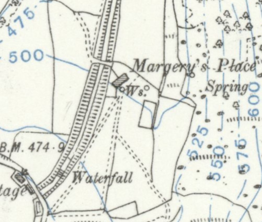
Margery’s Place ties together several old names. It was known as Garnet’s, then Gernest Bullough, evolving to Gernest and Gir Nest. On the 1847 Ordnance Survey map it is labelled Margery’s Place.
The site was also referred to as Margery’s Mine, describing the coal‑mining activities that took place here. An essay in Chorley Library notes that “Margery’s Place was reputed to be yet another drinking den,” suggesting its role as a social gathering spot as well as a farmstead.
Families & Residents
Churchwarden’s accounts trace the name changes across the years. Richard Skelton’s Landings (p. 88) records:
- 1787 – “Will Latham for W. Burton, ‘Garnets’, Anglezark.”
- 1854 – “I. Bain for John Winstanley, ‘Gir’ Nest’, Anglezark.”
The Ordnance Survey map preferred the name Margery’s Place rather than Gir’ Nest.
Beyond these fragments, little is known of the families who lived here. The site does not appear in Rawlinson’s About Rivington or in M.D. Smith’s books on Anglezarke and Rivington.
Farming & Daily Life
Coal mining was carried out at Margery’s Mine, and the farmstead was reputedly a drinking den.
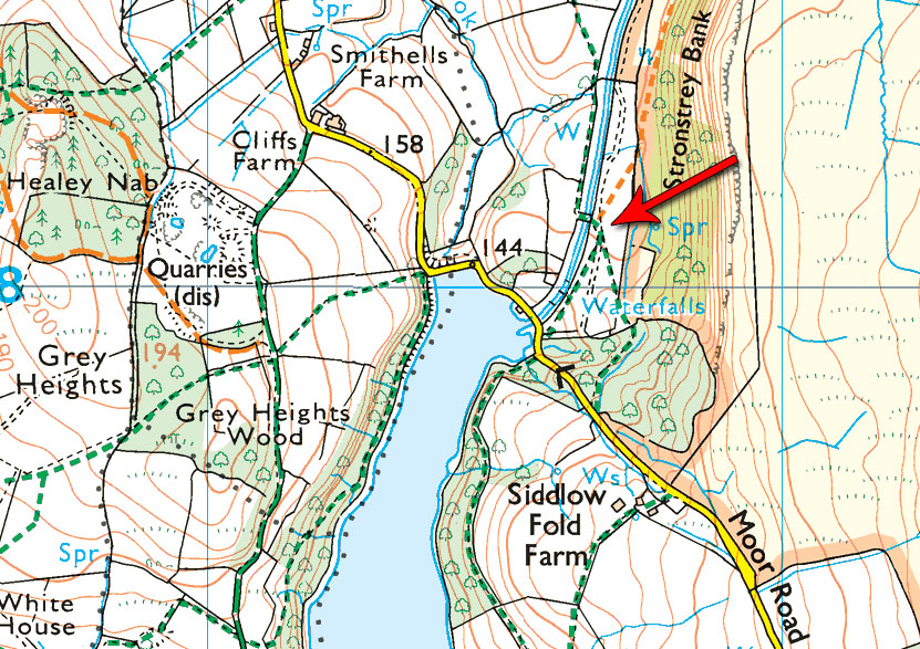
Its position along the Goit made it easily accessible, and the bridge nearby provided a crossing point for workers and visitors.
Architecture & Features
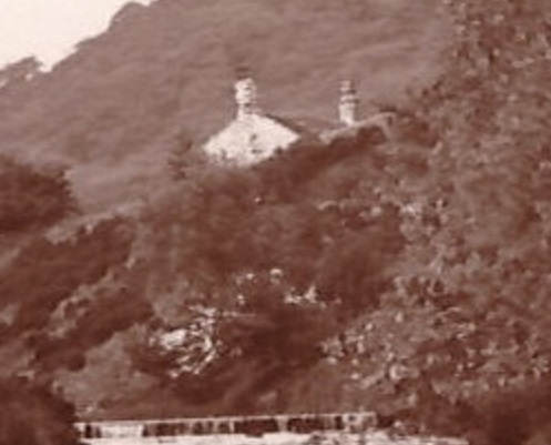
Absolutely no physical evidence of the dwelling survives today. The only known photograph of Margery’s Place was taken from a waterfall along the Goit by Waterman’s Cottage. The image shows the ruins in the distance, with a zoomed view providing “a grainy close‑up.”
The site itself is easy to reach: “simply head along the Goit from Waterman’s Cottage and after a few hundred yards there is a bridge over the watercourse. The ruins were here.”
Decline & Ruin
By the nineteenth century, Margery’s Place was already fading from memory.
The coal workings ceased, and the drinking den reputation lingered only in oral tradition. By the twentieth century, “there’s nothing at all to see now.”
Present Day
Today, Margery’s Place survives only in name and in the faint traces recorded in maps and churchwarden’s accounts. The photograph taken from Waterman’s Cottage may be “probably the only photograph in existence of Margery’s Place.” Walkers along the Goit can still cross the bridge where the ruins once stood, though no stones remain.