Stoops was one of the smaller dwellings on the Anglezarke moors. The name likely refers to its position near a bend in the brook, where the cart road passed by.
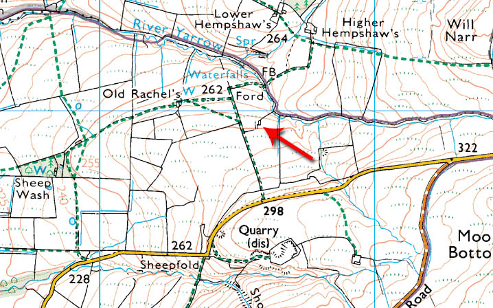
The barn was an extension of the house, much like Old Rachel’s and Wilkinson Bullough. A footpath that runs just west of the site was once a cart road, still used by wheeled vehicles today, including farmers’ 4x4s, linking Stoops to Hempshaw’s, Simms, and Lead Mines Clough.
Families & Residents
The earliest known family at Stoops were the Hiltons, present many decades before the Pilkingtons. It is possible that Nick Hilton, whose name is given to a bridge between Anglezarke and the M61 motorway, was among them.
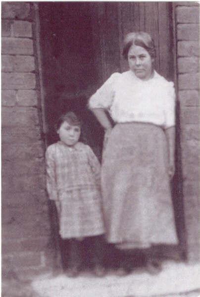
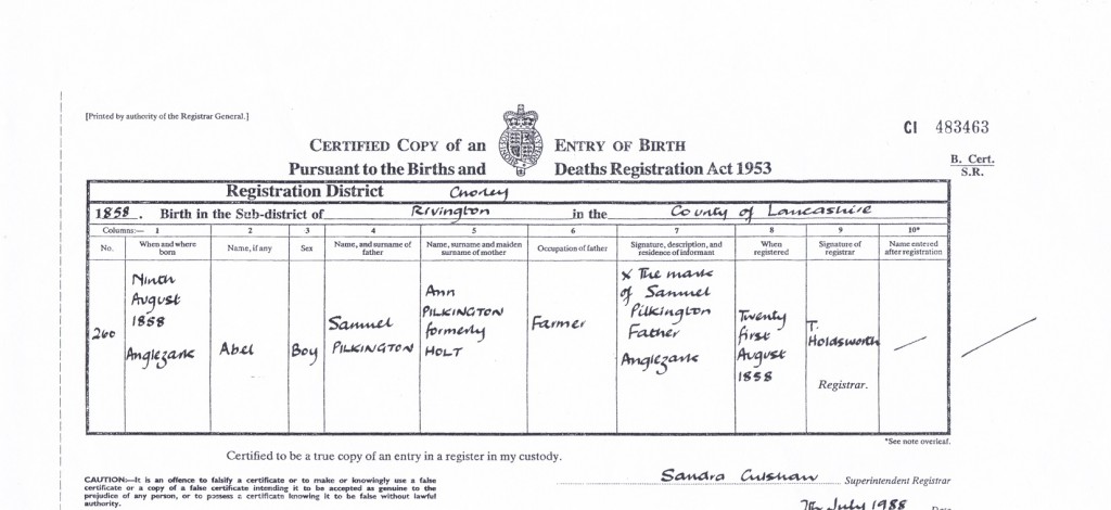
By the mid‑19th century, Abel Pilkington was resident at Stoops. Born in 1858, Abel was living here by 1868, aged about ten, and was probably born at the farm. He worked as a stockman, cowman, and shepherd. In 1901 he married Martha Evans, daughter of Henry and Hannah Evans of Old Rachel’s. Together they lived at Stoops and had two children: Samuel, born around 1900, who later married Florrie Matthews, and Hannah, born on 22 January 1902, who died on 27 November 1981.
Shortly after the birth of Samuel and Hannah, Liverpool Corporation bought out the moorland properties for water catchment and sent them to ruin. Abel and Martha moved to Moses Cocker’s Farm, where they had four more children: Lucy Ann, Thomas, Martha (junior), and George.
Farming & Daily Life
Stoops was a modest farmstead, with its barn serving as an extension of the house. The land was worked for cattle and sheep, and the cart road provided access for moving stock and supplies. The family lived a typical upland farming life, combining animal husbandry with seasonal work.
Architecture & Features
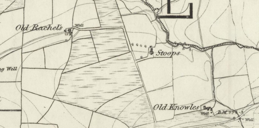
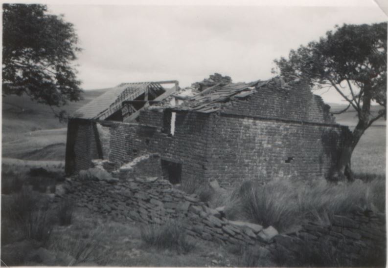
A local book from 1936 described Stoops as “a small cottage in ruinous condition, but the barn had been in recent use.” The site lies between the footpaths and the River Yarrow. The ruins were characterised by planted windbreaks of sycamore and birch, chosen for their hardy and quick‑growing qualities. While most Anglezarke ruins had southerly aspects, Stoops was more exposed, though still sheltered by the land.
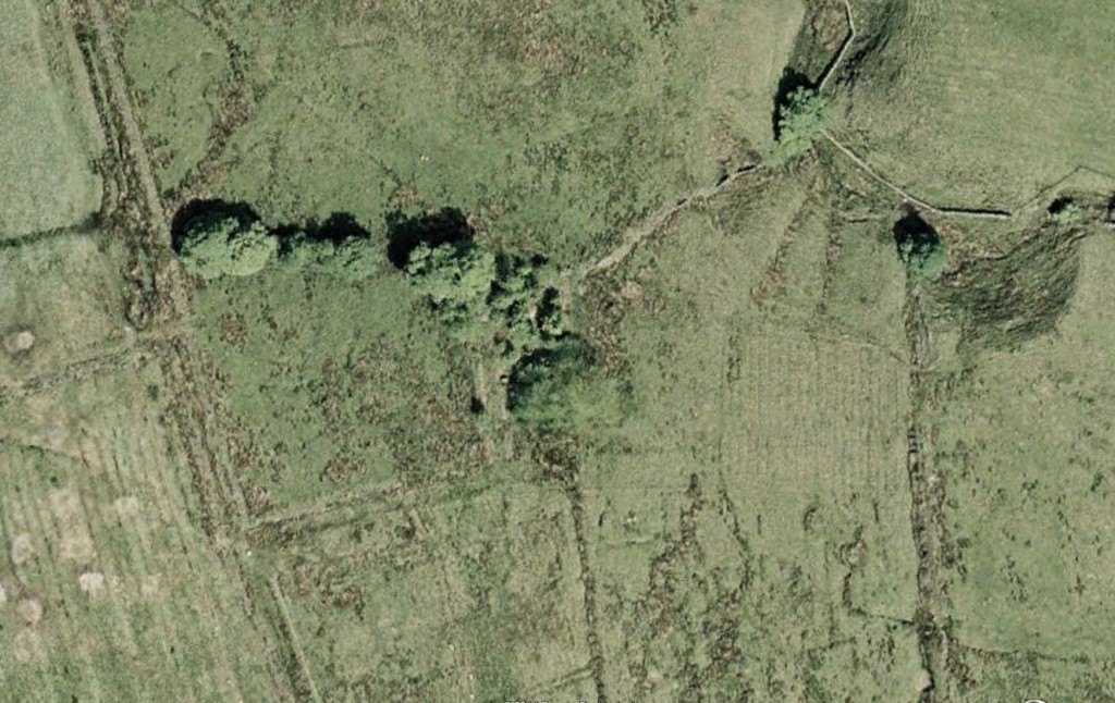
Photographs show the ruins centred among trees, which continue to thrive today. Comparison with old maps confirms the layout of the farmstead and its proximity to Old Rachel’s.
Decline & Ruin
The decline of Stoops followed the Liverpool Corporation’s acquisition of the moorland farms in the early 20th century. Families were forced to leave, and the properties were abandoned. By the mid‑20th century, Stoops was already ruinous, with only fragments of walls and foundations remaining.
Present Day
Today, Stoops survives only as a ruin, its outlines still visible among the trees. The footpath and cart road remain in use, linking the site to the wider moor. Though the cottage has long since vanished, Stoops retains its place in the story of Anglezarke — a small farmstead tied to the Pilkington and Evans families, remembered for its resilience and eventual decline under the pressures of reservoir construction.